
Tracing a Fort Mill Street
The Fort Mill street directory is strongest when it follows one address through the public land record. York County does not offer a public roster for everyone on a street. Instead, the defensible method is parcel by parcel: locate the address, capture its tax map ID and legal description, inspect the mapped parcel, and carry a known deed reference to the Register of Deeds. That can identify a property owner or a transaction party. It cannot establish every non-owner occupant at the address.
Work from a single exact location. Postal place names, Town limits, and parcel identity can differ. The goal is to keep the street number, parcel, subdivision, lot, block, and recorded document aligned before a name is treated as a useful Fort Mill street lead.
- Enter the physical address in York County Property Card Search or One Map and capture the property address, tax map ID, legal description, subdivision or lot, and latest deed or plat reference.
- Use One Map to select the mapped parcel, then pan and select adjacent parcels individually. Record each tax map ID rather than attempting a bulk street list.
- Take the latest deed book and page or instrument number to the ROD index. Compare the grantee, grantor, document date, and legal description with the parcel.
- For personal voter-registration verification, use the identity-gated state route or contact York County Elections. It is not a public street-browse tool.
- For an older address, ask the Library or Historical Center to confirm a dated reverse or criss-cross directory volume before using it as occupant evidence.
Fort Mill Street Property Cards
York County Property Card Search has three useful entry paths: address, taxmapid, and owner name. For a street search, the physical address is the safer starting key. It connects the returned record to a site, while an owner-name result can include more than one parcel or a trust or entity name. The card may show owner and mailing fields, property or situs address, legal description, valuation, land use, homestead field, latest deed or plat references, and a prior-owner or grantor field.
Those Fort Mill assessment fields create an address-to-document bridge. They do not create a list of private households. The assessed owner can be a person, estate, trustee, or entity, and the mailing address may only identify where the tax notice goes.
The York County Property Card Search identifies its address, taxmapid, and owner-name modes.
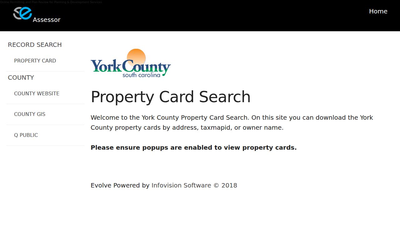
Preserving the card’s exact parcel and deed references makes the next Fort Mill street search more reliable than a name-only match.
| Address-search control | Type | Best Fort Mill use | Caution |
|---|---|---|---|
| Address | Primary text lookup | Find the physical site and property card. | Use the situs location, not a separate tax mailing address. |
| Tax Map ID | Primary text lookup | Reconnect a selected One Map parcel to the card. | Copy the displayed format rather than guessing it. |
| Owner name | Primary text lookup | Find a known assessed owner’s parcels. | It is not a complete resident search. |
| Property Card or Record Search | Navigation choice | Open the available County record path. | Popups must be enabled for card downloads. |
Fort Mill Streets in One Map
York County One Map supplies the spatial part of the Fort Mill street directory. Search an address, tax map ID, or subdivision, choose the parcel on the map, and inspect the property report. Its reported context can include jurisdiction, school district, zoning, flood, public-safety, utility, road, political, and imagery layers. A nearby Fort Mill polygon is an adjacent parcel clue, not a complete address roster.
The County’s documented adjacent-parcel method is simple: find an anchor parcel, pan or zoom to adjoining polygons, select one at a time, and move that parcel’s tax map ID to Property Card or the ROD. The research did not verify a public radius, buffer, or select-by-distance control. For a Fort Mill address, the Town GIS Hub is a useful second check for Town limits, ward, zoning, future land use, road responsibility, and water-provider context.
Note: County parcel geometry is approximate. A recorded plat and legal description, not a drawn map line, control when land boundaries matter.
Fort Mill Records by Street
Address-keyed records each answer a different part of a Fort Mill street question. The Property Card and One Map identify the parcel. Recorded deeds connect parties to a transaction. Plats translate a street location into lot, block, phase, and legal description. Town permit and code material may be held by Building & Codes, but the research did not find a public Town permit-result index. Request a defined address, record type, and date range through the Town when needed.
| Address record | What it supplies for a street | Official route | Boundary |
|---|---|---|---|
| Property Card | Parcel ID, owner, situs, mailing, legal description, and deed references | York County Assessor | Owner and mailing data are not a household list. |
| One Map | Parcel position, selected-parcel fields, and district or service context | York County GIS | Map lines are not a legal survey. |
| ROD deed and plat index | Parties, date, type, book and page, instrument number, and property-description route | York County Clerk / ROD | No direct street-address field is displayed. |
| Town permit or code material | Defined address, lot, permit, inspection, or code records that the Town holds | Building & Codes and Town FOIA | No verified public historic result index. |
| Historic address volume | A dated printed address or occupant lead | Library, Historical Center, or Museum | Confirm the actual volume and year first. |
A Fort Mill tax map ID and legal description join the County’s records more reliably than a street name alone. The street name can change form across a directory, map, or deed, while the land description and plat can control the match.
Fort Mill Street Deed Links
Use the property card’s latest deed book and page, latest plat reference, or instrument number to enter York County Land Record Search. The ROD form supports grantor and grantee name paths, book and page, instrument number, date range, document categories, and property-description fields for subdivision, lot, block, section, map, phase, unit, and description. This is the route from a street address to a recorded land document, not an address search box.
Choose a narrow document category and date span whenever the Fort Mill parcel facts support it. The Standard name search removes punctuation, spaces, and special characters. Pre-1997 date entries are recorded year-only and convert to 00/00/YYYY. The user must compare the legal description at every link because lots can be divided or recombined and similar street numbers can refer to different land.
The York County Land Record Search provides the grantor, grantee, book-page, instrument, and property-description routes.
The image reflects the index entry points. A deed party is a record role, so the parcel and legal description still need to be checked before using the result for a Fort Mill street conclusion.
- Parcel
- A County land unit identified through the tax map and assessment record.
- Situs address
- The physical parcel location, separate from the tax mailing address.
- Plat
- A recorded map that can connect an address to a lot, block, phase, or subdivision.
- Criss-cross directory
- A historical address arrangement, useful only when a specific local run has been confirmed.
Fort Mill Street Online Cutoffs
York County’s web coverage has a definite boundary. Deeds and all plats begin online January 1, 1979, while mortgages begin online July 1, 1982. That boundary is important for a Fort Mill street directory search that reaches into older property history. Once the web index stops, the documented Fort Mill research channel is the Register of Deeds counter, historical books, or its available networked public computers.
The ROD counter is at 6 South Congress Street in York. The office reports normal weekday hours of 8 a.m. to 5 p.m., with the record room closing at 4:45 p.m. Call the office for a specified book, plat, or document-copy question. The office does not perform title searches, interpret another office’s records, prepare deeds, or provide legal advice.
For a past occupant question, move from the deed chain to a verified historical collection instead of assuming that a transaction party was the person at the address.
Fort Mill Street Legacy Names
The York County address service preserves fields for Legacy Street Name, Legacy Street Type, and Legacy Suffix Direction. These fields provide a more honest continuity clue than inventing a Fort Mill mass-renumbering story. The research did not locate an official Fort Mill street-renumbering or mass street-rename year. When an older directory label and a modern address do not match, search the legacy field and then compare the subdivision, phase, lot, block, recorded plat, and legal description.
The service also separates house number, unit components, street components, ZIP and ZIP+4, Municipality, ZIP Community, and subdivision information. That matters for condos, apartments, townhomes, or changed parcel layouts, where a loose street match may be wrong. A postal ZIP is not a Town boundary and a map edit date is not a move-in date.
York County’s address-service schema documents the legacy, municipal, postal, and subdivision fields used for address continuity.
Fort Mill Street Permit Records
A Town permit, inspection, or code file can be an address-keyed record, but it is not an automatic public occupant record. Fort Mill Building & Codes has forms and intake channels for permits, inspections, and code matters. The current inspection process uses details such as lot number, address, permit number, inspection type, contractor, contact name, and telephone. The research did not locate a public historical permit-by-address results screen.
For a Fort Mill record the Town holds but does not publish as a result, submit a narrow Town FOIA request. Include the address, parcel or lot number when known, document class, and date range. Inspection results are not supplied by phone. Older PDFs can show former counter locations, so use the current Town FOIA page or call the Municipal Clerk before delivery.
Fort Mill’s FOIA route is the Town channel for a defined existing municipal record.
Fort Mill Street Boundary Checks
A Fort Mill mailing identity does not itself place a parcel inside the incorporated Town. County data separates ZIP Code from Municipality and ZIP Community. The Town GIS Hub, announced in 2025, adds Town-limit, zoning, ward, future-land-use, road-responsibility, water-provider, and neighborhood context. A Fort Mill street directory should keep that location context separate from the parcel and people-record questions.
The County One Map and Town Hub explain where a Fort Mill place sits. A recorded plat or legal description is still the land-verification path. When the map or address record appears wrong, York County GIS provides a parcel and address correction route; preserve the source field and parcel details when reporting the discrepancy.
Note: A map result can confirm local context, but it cannot identify who occupies a Fort Mill address.
Limits of a Fort Mill Street Directory
A Fort Mill street directory cannot show every person connected to a street. The assessed owner, mailing recipient, deed party, permit contact, or historical directory entry each have a limited meaning. Public utility and delivery lists are not part of the parcel record. Motor-vehicle address data are governed by separate privacy limits. The state self-service voter form requires identifying information and does not support a street search.
Fort Mill protected addresses, sealed records, and statutory confidentiality programs must remain protected. An apparent gap is not permission to work around it with unrelated records. For current address questions, use the responsible office’s official correction or access process. For older history, identify the specific date and collection rather than recasting a map or owner field as residency proof.